


Customize
About Item
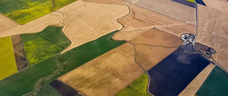
Satellite & Remote Sensing-Based Claim Assessment Service is a technology-driven agricultural insurance support solution that uses satellite imagery, drone surveys, and geospatial analytics to assess crop health, damage extent, and yield loss. This service enables faster, transparent, and accurate insurance claim verification without extensive physical field inspections.
Overview
Satellite & Remote Sensing-Based Claim Assessment Service is a modern agri-insurance support system designed to improve the accuracy and efficiency of crop damage assessment. Traditional claim verification methods often rely on manual field inspections, which can be time-consuming, costly, and prone to disputes.
By leveraging high-resolution satellite imagery, drone mapping, GIS tools, and vegetation indices (such as NDVI), this service provides objective data-driven insights into crop health and damage severity. Insurance companies, government agencies, and agri-finance institutions use this technology to validate claims, estimate yield loss, and detect affected areas with precision.
This service plays a crucial role in parametric insurance models, yield-based insurance schemes, and disaster response programs.
Key Technologies Used
1. Satellite Imaging
Multi-spectral crop health monitoring
Large-area coverage assessment
Pre- and post-event comparison analysis
2. NDVI & Vegetation Indices
Crop vigor measurement
Early stress detection
Drought and flood impact evaluation
3. Drone-Based Surveys
High-resolution field mapping
Localized damage verification
Evidence documentation
4. GIS & Geospatial Analytics
Boundary mapping
Area-wise loss estimation
Digital claim documentation
How It Supports Insurance
📡 Rapid damage identification after disasters
📊 Objective yield estimation support
⚡ Faster claim settlement process
🧾 Reduced disputes and fraud detection
🌍 Scalable for district/state/national programs
Major Benefits
Increased transparency in claim processing
Reduced administrative costs
Faster response during natural disasters
Data-backed decision-making
Improved accuracy compared to manual assessments
Ideal Users
Insurance companies
Government crop insurance schemes
Agricultural cooperatives
Agri-finance institutions
Disaster management authorities
Additional Service Enhancements
Real-time satellite monitoring dashboard
Historical crop performance analytics
Mobile-based geo-tagged photo submission
Integration with weather index platforms
AI-powered yield prediction modeling